


Categories
Results 1 - 11 of 11
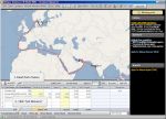
The world's best port distance database :More than 7 000 ports and 25 000 000 distancesConvenient visual route and world map A number of routing points choice e-Port atlas functionEasy route editingAd ...
Category:Distance

www.pcmaritime.co.uk/comm/index.htm
Navigation programsLarge range of navigation solutions and CBT ISM training software available. Navmaster is developing towards ECDIS standards. Used for emergency response and onboard SOLAS vessels
Category:Navigation programs
hop.clickbank.net/?infomarine.eomarg
Software On SaleCreando tu Futuro en Internet.
Category:Internet solutions
hop.clickbank.net/?infomarine.npscripts
Software On SaleNothing but Perl Scripts. Free and premium scripts for many purposes. Created with ease of use and power in mind.
Category:Internet solutions
Softwares Solutions. Manufacturers of data communications software to reduce time and money when sending or receiving over satellite or GSM
Category:Business Software
www.infomarine.gr/seamanship/deck_officer14.htm
Applications for Passage Planning Astronomical Navigation World Wide Tides and Onscreen Distance Tables
Category:Maritime Training
www.infomarine.gr/seamanship/yachting3.htm
Navigation Software for the deepwater sailor and ocean voyages. Applications for Passage Planning Astronomical Navigation World Wide Tides and Onscreen Distance Tables
Category:Maritime Training
Communication. Manufacturers of data solutions software designed to reduce time and money over satellite and GSM communications by compression full duplex least cost routing
Category:Communications


|

|


 carrier newbuildings")


 took successful delivery of the newbuilding vessel M/T ‘Agisilaos’, a 50,000 dwt,")
